Tenaya
July
2015
Part Two
The Corinth Canal
and Gulf of Corinth, Greece
| |
| HOME |
| About Tenaya |
| About Us |
| Latest Update |
| Logs from Current Year |
| Logs from Previous Years |
| Katie's View |
| Route Map |
| Links |
| Contact Us |
![]()
18 July 2015
Corinth Canal
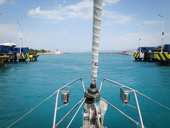
The Corinth Canal is a four mile long, 25 meter wide slice through limestone that allows boats to pass between the Aegean and Ionian Seas. It separates the Peloponnese Peninsula from mainland Greece and saves boats a 200 mile trip around. At the highest point, the walls reach 79 meters. One railway and two road bridges span it and at each end lies a submersible road bridge. The depth is at least 6.5 meters.
With a forecast of single digit winds from the east, we left the anchorage at Korfos at 7:00am and headed west towards the canal. By 9:00am we had 18 knots. From the west.
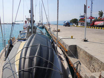
It blew 20+ knots until we got very close to the wall at Isthmia shortly after 10:00am. After paying our 197 euro transit fee and topping up the diesel tank, we followed three larger boats in. One smaller sailboat was behind us. The Frenchman aboard was finishing a circumnavigation and happy to be almost home. While Tenaya was riding a transport ship past the Horn of Africa and through the Suez Canal, this guy was on his own keel.
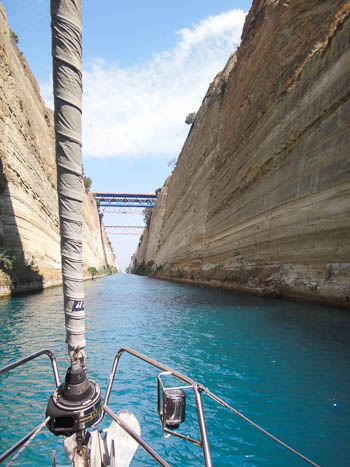
During the 45 minute transit Jim and I gaped at the sheer walls and admired the turquoise water which is incredibly clear because of the limestone.
Passing the second submersible bridge we were hit, once again, by 20 knot winds forward of the beam. It wasn't yet noon so we sailed 33 miles to Antikyra on the northern shore of the Gulf of Corinth. The closer we got, the more the wind subsided.
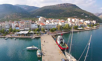
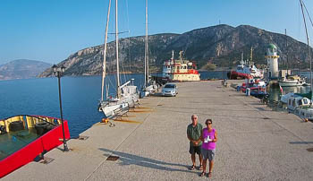
Antikyra
38 22'.57N : 020 38'.02E
We had read about Antikyra on a friend's blog and hoped to meet a couple who befriended them. That didn't work out, but we enjoyed the gorgeous surroundings - tall mountains with deep ravines around the large bay - and met other cruisers also tied to the wide dock. It was a great place for me to try flying the drone for the first time.
As we dined at a covered outdoor taverna, a storm blew through with pouring rain, booming thunder, and crackling lightning which seemed to strike all sides of the bay. The following morning fluffly white clouds floated over the mountains beneath a brilliant blue sky.
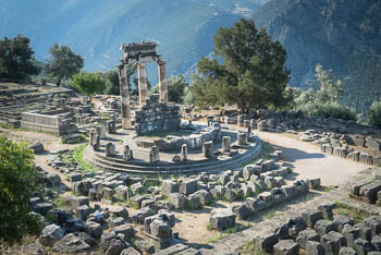
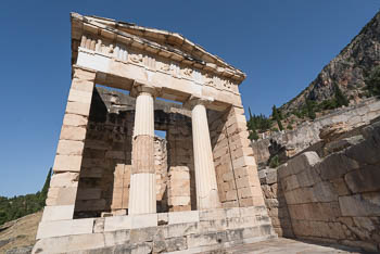
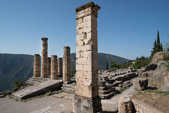
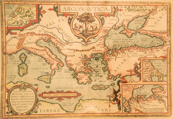
Delphi
Considered by ancient Greeks as the center of the world, the creation of Delphi began in the 7th century BC on the flank of Mt. Parnassos amid sheer cliffs, deep ravines and rocky outcroppings. Pilgrims from all over Greece came to seek advice from the oracle of Apollo at this magical Pan-Hellenic sanctuary. Through the centuries, as Delphi grew in political importance, more buildings were added.
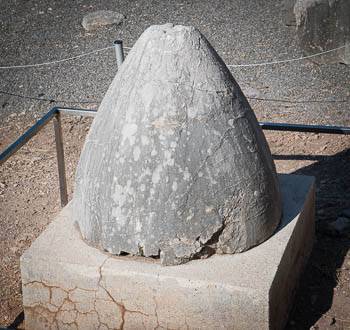
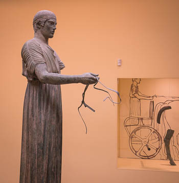
Jim and I followed a terraced route from the Temple of Apollo and the Altar of the Chians up to the treasury, polygonal wall, stoa, the conical stone navel representing the center of the ancient world, the sacred Castaian spring, past the theater, and up to the stadium. Back down at street level, we visited the museum which houses, among other treasures, the exquisite bronze Charioteer. We were pleased we came early before it got too hot and the hoardes of tourist busses arrived.
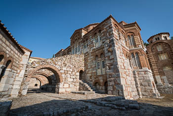
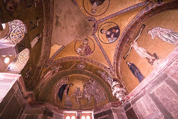
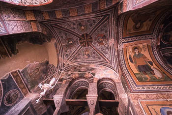
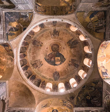
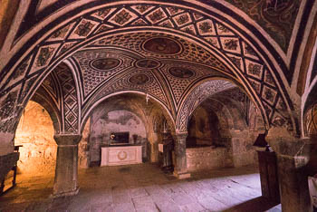
The Monastery of Hosios Lukas
37 miles past Delphi, towards Athens, is the Monastery of Hosios Lukas, a Byzantine church built for pilgrims in the 11th century. It is named after a hermit, Lukas the Stiriote, who made his home here in the ruins of a former temple in the 10th century.
Thananis, the taxi owner who took us to Delphi, was surprised we wanted to visit the monastery the following day. The famous ruins and the airport are the usual requests. How nice it was to listen to him explain the different types of olives in the region, and their uses, as we rode in his comfortable Mercedes AMG diesel.
I love mosaics and had read that the monastery has some of the finest in Greece. Indeed, they are very well preserved and shine beautifully on golden backgrounds. There are also extensive marble works and colorful frescoes inside the domed, vaulted, multi-chambered church.
Galaxidi
38 22'.58N : 022 23'.25E
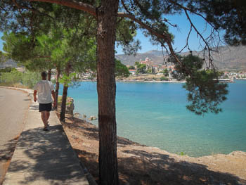
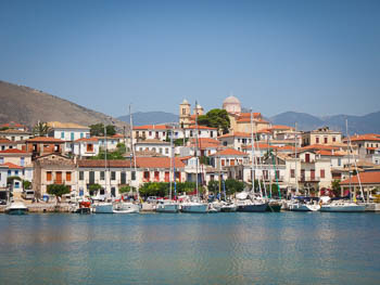
On July 12 we motored 17 miles further west along the calm sea to another large bay. There are many along this scalloped coastline. The small town of Galaxidi wasn't visible until Tenaya passed two tiny islands and made a 90 degree turn to port. Then, wow!
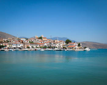
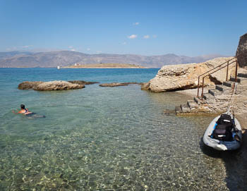
A scenic and protected harbor came into view. Two bays are separated by a hilly point clustered with colorful houses and topped with a domed church. Three boats floated at anchor in one but we headed into the other where a line of masts signaled our destination.
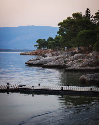
People were swimming around their boats and, across the narrow bay, others were wading in private pebbly coves between rocky fingers. Hills covered in cypress and olive trees rolled away from the shore and became tall mountains in the north where Parnassos National Park is located.
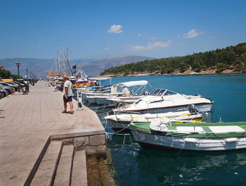
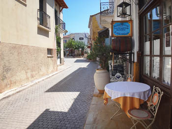
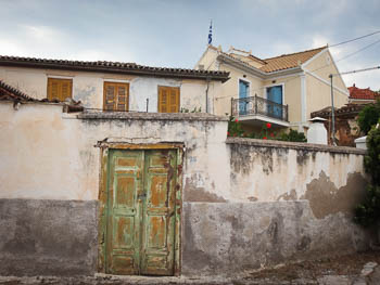
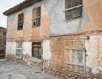
Along the concrete quay is a row of restaurants specializing is seafood. Behind is a warren of narrow, cobbled streets lined with buildings in various stages of decorum and decay.
This was an excellent base to visit Delphi and the Monastery of Hosios Lukas, both UNESCO Heritage Sites. It was also a gorgeous place to kayak and swim. Could you imagine boating here in the summer and skiing on Mt. Parnassos, only an hour away, in the winter? With delicious meals and a low cost of living? We could.
Jim and I were not the only people to appreciate this lovely harbor. Named Chaleion in the 7th-9th centuries, it has been an important nautical base for at least 1,000 years.
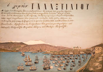
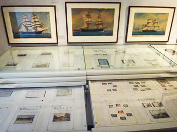
Galaxidi became a major shipbuilding site with a commercial sailing fleet in 1830. The compact, comprehensive Nautical & Historical Museum details the history with paintings, photos, maps, charts, weapons and bits of boats. It also has shelves of stamps and papers from around the world.
I'm not sure why the yachties we met in Kos were so unfriendly. They've been really nice everywhere else. Here in Galaxidi we were anchored between Alex and Nina from Slovenia and a young family with their in-laws from Austria. Both were super friendly and gave us great information about visiting Croatia.
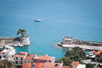
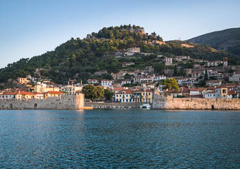
Nafpaktos
38 29'.46N : 021 49'.81E
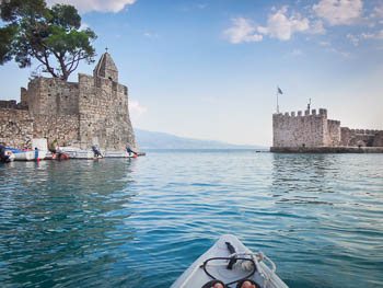
On July 15 we sailed - yes, sailed - 26 miles west to Nafpaktos. Why? The city has one of the best preserved medieval harbors in the Mediterranean.
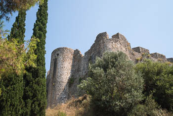
The guidebook suggests boats over 12 meters anchor outside so that's what we did. Secure on the sticky bottom, we kayaked in to have a look and hike up to the castle high on the hill.
It closes at 3:00pm. We arrived at 3:37. Not completely discouraged, we continued up a dirt road to the summit and tried to find a way in. We couldn't, of course, it's a fortress. The 90+ degree heat would have dissuaded us had we known. But, back at the harbor as we indulged in ice cream, we were glad for the exercise and experience of seeing another Greek neighborhood.
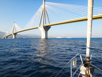
The following day we motored under the Rion Bridge, through the Gulf of Patras, and into the Ionian Sea.
Go to July 2015 Part Three - Zakynthos, Kefallonia, Preveza & Corfu - Ionian Sea, Greece
![]()